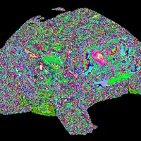
NL-aerial segmentation
This is a segformer segmentation model finetuned on random samples from the entire 41,000 square kilometer of aerial photography data, see pdok aerial data, and using the BGT, see pdok BGT data. Specifically it takes in 1024x1024 aerial photographs taken at a resolution of 8cm/pixel and predicts water, buildings, roads/pavement, vegetation. This model is part of the NL-veranderdetectie project, summary in dutch. The model was trained using this codebase, see the repo for more details.
Model Details
Regular segformer, with the classification head adjusted to 5 classes.
Model Description
- Developed by: Het Waterschapshuis, in collaboration with the Dutch Waterboards [More Information Needed]
- Model type: [Segformer Semantic Segmentation Model]
- License: [MIT]
- Finetuned from model: [nvidia/segformer-b1-finetuned-cityscapes-1024-1024]
Model Sources [optional]
- Downloads last month
- 191
Inference Providers
NEW
This model isn't deployed by any Inference Provider.
🙋
Ask for provider support